10 March 2013

The Green Rock

At about 100 km north of Bucharest, in the Subcarpathian region, lies the Slanic Prahova resort. It is a city developed around a salt extracting facility. Above this little town there is curious rock formation coloured light green, which can be reached after a fierce climb.

The colour is determined by the chemical composition, mainly clinoptilolite , a complex hidrated Sodium Potassium Calcium Aluminum Silicate. It has the interesting property of absorbing cations, having been used even for detoxification of the environment after the Tschernobyl accident.

This being said I decided to go there, visit Slanic, take the climb under my wheels and see the rock for myself. It happened on August 28th 2011. 

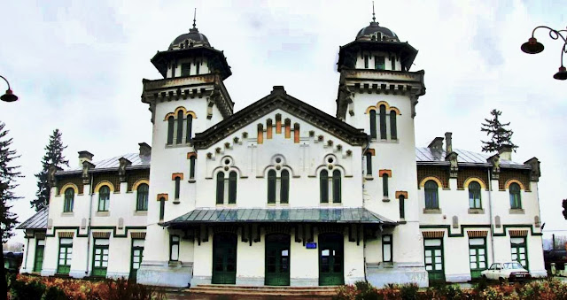
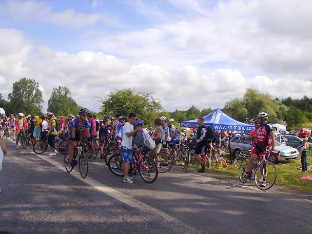
At 8.30 AM I got down from the train in Ploiesti Sud station heading to Gageni and Plopeni (DJ 102 road), with significant traffic in the weekend.
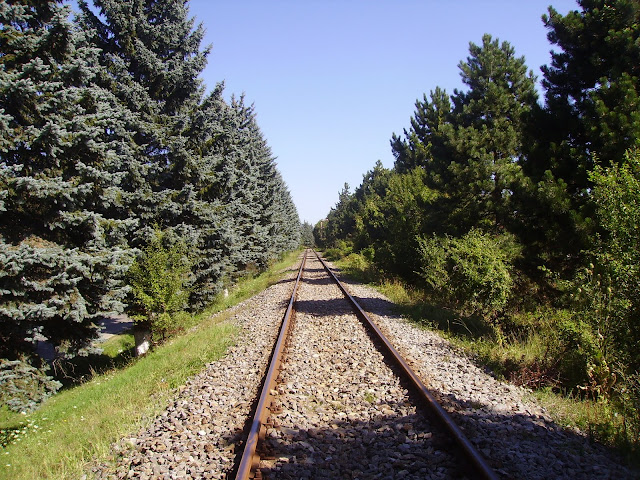
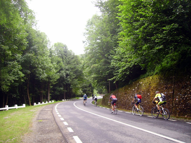
After Plopeni, the railroad linking Ploiesti to Slanic is accompanying the road until its final destination. There is now a direct train from Bucharest, run by the private operator TransFeroviar every morning.

PICT1859.JPG

I's a road worth taking by bike - with hills and valleys, passing through nice villages.
PICT1851.JPG 

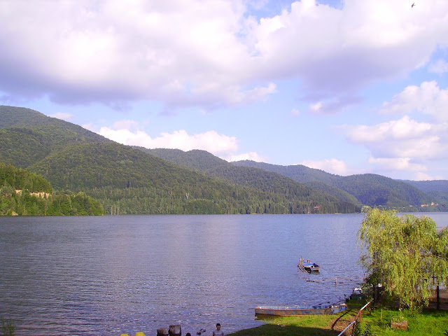
I finally arrived in Slanic and stopped for a little break.
The resort was full of people, came to enjoy the sunbeam on the shore of the Salt Lake, as well as visiting the underground saline.
PICT1865.JPG

Then I headed straight to the green mountain, which can be observed from the resort's centre. You just have to follow the Green Rock street ("Piatra Verde", in Romanian).
PICT1869.JPG

PICT1870.JPG

The road is paved in concrete blocks, as it was too steep to be asphalted conventionally. It  climbs 200 metre along an 1.5 km route to the top.
PICT1867.JPG


PICT1874.jpg

The panorama that unfolds above fully rewards the daring cyclist. It's quiet because few people are going up there to disturb nature.
PICT1881.JPG

PICT1879.JPG

A driver had just stopped his car to allow the engine and the boiling water to cool off. He goggled owards me and my bike and said I deserved a picture after this devilish climb 
PICT1894.JPG

From the Green Rock the road descends through a forest.
PICT1898.JPG

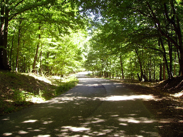
After coming out of it, you can admire the Grohotis Mountains to North-West.
PICT1902.JPG
Then I returned to Ploiesti along DN1A national, again a crowded road. But it didn't matter, as I saw what I wanted along my trip.

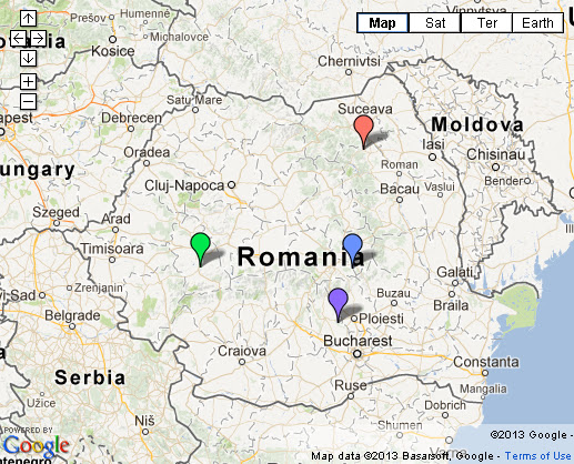
This is the map of the little tour taken :

Some nice spots this country has, especially when discovered by bike !  

6 March 2013

Transfăgăraşan - on top of Romania


The man said : "If you’re a fan of television’s British Top Gear series, you’ll probably have heard of this road. It’s called the Transfăgăraşan and it was rated by the Top Gear trio as the best driving road in the world.
It is a very difficult point to argue, other than to say that it’s also probably one of the best roads for two wheelers on the planet."

It's the opinion of a motorbiker. I've climbed this road (the national road DN 7c) 5 times already, as a two-wheeler, but only under my own burned calories - that is to say, as a cyclist only.  Never alone, always with friends of my sort.  So it's time to tell a story about this road.
It links Wallachia (the southern historical province of Romania) with Transylvania (located centrally, within the Carpathian arch). At it's southern tip, it begins in Piteşti, passes through Curtea de Argeş, climbs to barrage lake Vidraru (built on Argeş river) and then ascends to Bâlea Lake (2040 m), through a tunnel boared in the mountain's top (not through a regular pass). 
At it's northern tip, it detaches from main road DN1 (Sibiu-Brasov) near the village of Cârtişoara and ascends to Bâlea waterfall and then, on a highly spectacular course, to Bâlea Lake. This is the section that earned it's reputation inside and outside Romania. Due to heavy snow in the winter, the road is open usually between July 1st and October 31st.

The Southern Side

As I live in Bucharest, this was the first side that I climbed. It happened in 2010, together with some of my friends cyclists, while en route to the annual cyclists' meeting in Cârtişoara. There were 3 adventurous days which I will not ever forget. In the morning of July 30th I took a train from Bucharest to Curtea de Argeş, together with about 15 fellows cyclists.
The Curtea de Arges railwaystation building is some piece of architecture
gara%2520CdArges.jpg


In Curtea de Argeş, former capital of Wallachia, we stopped a moment at the most well known historical monument, the Monastery, built between 1512-1517 under the rule of Neagoe Basarab (mural picture finished 1526).  
manastire1.JPG

It serves as a royal necropolis, as the following Romanian monarchs have been buried here : King Charles I and Queen Elisabeth of Romania, King Ferdinand and Queen Mary of Romania, King Charles II. It is also a symbol of Romanian orthodoxism, receiving over 100.000 pilgrims and tourists a year. 
manastire2.JPG

Then off we got on our way to Arefu, the last commune before steep climb to Vidraru lake begun. If one looks upwards to north-west, the Poenari citadel can be seen, marking the beginning of the slope. The remains of this citadel are today a museum, to be reached after climbing 1480 stairs. It was first documented at 1500, but the builder remains unknown. We only know that it was later used by Vlad the Impaler, ruler of Wallachia, for military purposes (not permanent habitation). 
PICT1642.JPG

The road was paved with poor quality asphalt at the time, full of potholes, before and along the lake. Now, as of 2012, the situation has improved much and you feel comfortable while riding even a race bike. 
transpic1.JPG

At Vidraru dam we decided to take left on an unpaved road, leading us to Cumpăna chalet, where I had accomodation booked overnight. As I came on my hybrid bike, meant mostly for the road, it was a bit harder, but I managed to arrive safely at the chalet.

cumpanacx.JPG

cumpana.JPG

The others  slept in their tents, on the lake's shore. 

It's there where I came to meet them again the next morning. The landscape at sunset and sunrise did worth all efforts taken until now.
PICT1105.JPG

It was the Big Day, when we were supposed to do the Great Climb and meet with fellow cyclists from all over the country at the base camp in Cârtişoara, on the northern side. After escaping the forest road, I met the real deal and hurried up to catch up with the people. It happened near the Black Peak chalet ("Piscul Negru"), where we stopped a bit for a beer and chat. 

Then up we rode again. The real ascension begins 15 km before Bâlea Lake, after a bridge above the Capra ("goat") rivulet. 
PICT1686.JPG

The scenery is breathtaking, and this gets amplified by the fact that I am here for the first time ever. I am climbing, stopping to take pictures and then up in the saddle. 
PICT1688.JPG

8 km from Bâlea Lake chalet we stopped for lunch at Capra chalet. Having the internal batteries recharged, the Ride continued.
PICT1153.JPG


Quick stop at the Capra waterfall.
PICT1160.JPG

A mild fog was embracing us as we were beyond 1700 m altitude. At 2000 m I got down and looked back.  Jesus, I couldnt imagine I would get here on 2 human-powered wheels! It felt great.
PICT1175.JPG

pano.jpg

But then this enthusiasm got a bit tempered by the unlit tunnel linking the southern and northern side. Thanks God, it is now lit, as local authorities worked on electrification here. But had it been lit then, I would have not entered a deep pothole in the ground and fell off the bike. It was ok for me, but not for the front tire. 

Having reached the Bâlea Lake chalet, a hot tea and Romanian sour soup were needed (temperature was as low as 10 degrees Celsius).
Balea.jpg

Be aware the traffic in weekends is very high. Therefore I could see that everyone was parked everywhere. Cyclists continue to be an exotic appearance in Romania but their number is constantly increasing. The atitude of the public is also slowly getting better. At that moment only the significant amount (around 400) told the motorists that we are having a special event here. The road and mountain is ours too and we will gladly share it and protect it together.
over%2520the%2520top.JPG

The Northern Side

It took me another 2 years to reach the top again on the northern side.  This time I came on my mountainbike, as the hybrid was in bad shape. 
Wednesday, July 27th, I got up on a train from Bucharest to Ucea. From Ucea I rode (together with 5 or 6 fellows) to the base camp in Cârtişoara. I slept in one of the many tourist pensions that this village is hosting, waiting for tourists all summer.
trans%2520urcare%25202012.jpg

The next morning we met at the camp (again 4-500 people, including families with kids) and triumphantly began the climb.
PICT1808.JPG

There are 22 steep kilometers until the top, with extraordinary sights along the way. You first navigate your way through a forest. The road leads you to the Bâlea Waterfall chalet. 
PICT1813.JPG

You can take lunch or, if you get here by car, you can take the cable car to the top. We did none of those things, just took a break and bought a few souvenirs for my family back home, then began the climb again. 
PICT1840.JPG

The forest ends at some point and you end up in the upper alpine section, along the winding road, with it's curves, hairpins, bridges and that unique scenery that would make almost every hiker, trekker, cyclist, motorbiker and driver to dream of it.
Trans%25202012%2520043.jpg

Trans%25202012%2520026.jpg

Trans%25202012%2520025.jpg

I stopped and took pictures of all these and talked about it with unknown fellow cyclists that I met along the Great Road.
Trans%25202012%2520013.jpg

Trans%25202012%2520016.jpg

Bear in mind that the northern side will undergo complete road restauration during the 2013 summer, so it will be closed for car traffic. Nevertheless you can still reach the Bâlea Lake chalet ascending from the south, as shown above.

All along, with all breaks taken for pictures and rehydration (the weather was great, maybe even too warm) it took me 3 and 1/2 hours to reach the top and enjoy a well deserved beer and lunch. 
Trans%25202012%2520009.jpg

An unannounced rain took us by surprise, so we had to stay inside for an hour or two, chattering about everything. But afterwards the sun appeared again and a beautiful sunset guided us on the descent back to Cârtişoara. 

Take care when descending, you need to have good brakes and nerves of steel. Having a functional bike, you will however succeed, even if you are a beginner in this cycling bussiness  .
trans%2520coborare%25202012.jpg

The map indicating the whereabouts is here : map

Thanks for reading this and be welcome to Romania, there are plenty beatiful places to see and feel!

Pictures by (and thanks to) : Traveller, micsunica, ciclism.ro, rocky_marian, ombun, ciprian_m.

5 March 2013

The National Buffalo Reserve "Neagra" Bucşani


At about 60 km north-west from Bucharest, in the Dâmboviţa county, there lies almost unknown by anyone, the biggest European Buffalo Reserve in Romania, called “Neagra” ("the black one"), in the Bucşani commune.

I discovered it by pure chance while searching on Google Maps, after an old habbit of mine.

The European Buffalo (Bison bonasus), old symbol of the Carpathian Mountains, has been declared ''species close to extinction'' in 1996 in Romania.

There are today 4 National Buffalo Reserves in Romania : Haţeg, Vama Buzăului, Neamţ and Neagra- Bucşani (as displayed on the map below):
Ro%2520Zimbri.jpg

This being said (and having discovered one of these so close to Bucharest), I decided to go and see what I've never seen before.
The map is displayed here:

To avoid the crowded national road DN7  to Târgovişte, I got up on a train and got down in Titu station. 
PICT1919_mac.jpg

The county road DJ 701 leaves Titu by north, passes through Branistea and it has been recently paved with very good quality asphalt until Dobra. Traffic is also low.

At Moara Nou
ă village I crossed Dâmboviţa, the river which eventually will reach Bucharest.
PICT1923_mac.jpg

I'm passing through little villages with funny names such as Bolovani (Boulders) and Cornăţelu (Tiny Corner). I then take a left turn in Dobra. The impecable asphalt is replaced by an uneven one, as if I was rolling on octogonal wheels.

After leaving Dobra, on the right hand side, the road crosses the Ialomiţa river on a new bridge. The river's water is crisp and clear but few, due to lack of rain and intense heat over the past weeks. However, the people can still bring the cattle to drink.
PICT1930_mac.jpg

The fun is over for some kilometres, as turning left from Mărceşti village the road becomes full of potholes. Still, the traffic is very low. Escaping those potholes (which may not exist anymore today, if the road has been repaired as scheduled in 2012), my bike and I finally enter the Răţoaia village, belonging to Bucşani commune, and take right on very good asphalt. This is the road which will lead us to the woody hill that is keeping the reserve hidden.
PICT1936.JPG

Be aware that there's no indicator, you just need to know your way around the map.

The asphalt section ends and I follow the forest road.
PICT1938_mac.jpg

The ABSOLUTE QUIET rules here. The forest kindly surrounds the traveller and, from time to time , you can hear just some discreet crickets' sounds and acorns felling from the old oaks.
PICT1942_mac.jpg

The road is gravel with compacted cobble, but my old crosser is up to the challenge, and so am I.

When reaching a wide space surrounded by fence, you must go forward. Then you will reach a T-shaped crossing and take right.

And there we are. The caretaker appears. I'm paying the entry tax of 4 RON (1 Euro) and I am invited on the reserve's territory. It's an immense 450 acres park, home of 39 buffalos to date (of which 5 fresh cubs).

I had read some review on the internet and not all visitors were lucky enough to actually see buffalos (they stay in the woods during summer) but, as I came in the late fall, I could see them.
3 were around and taking a siesta, so I was able to admire them in full splendor.
PICT1951_mac.jpg

PICT1956_mac.jpg

PICT1963.JPG

The rest were grazing in the woods. A buffalo needs a personal space of around 12 acres. Its medium lifespan is 25 years and the male reaches 1 tone weight.

By founding this reserve, the state managed to perfom their acclimatization in the plains, in a space large enough to give the buffalo population a high degree of comfort.

I sat there with the caretaker for an hour, chatting. From time to time, we just shut up, admiring the animals and hear the silence. Afterwards we said goodbye and I began te return, having gained some kind of special "momentum" after this encounter.

I just stopped for a quick lunch break on the outskirts of the Răţoaia village, marked by an old great oak. There a happy bike, although covered in dust smile.gif
PICT1967.JPG

And in the end one more picture of the Dâmboviţa river, with people who had gathered on the shore for fishing, in a beautiful Sunday afternoon, on a late fall ...
PICT1969_mac.jpg

More infos on the Reserve here: Bucsani Dambovita

Other pictures - here