Having already begun to take a tour along this beautiful region, I continued and took the second.
Therefore, on Monday May 24th, I got up on the bike-friendly A 1745 train to Brasov.

A huge crowd was already installed in the bike-carriage – about 20 (!) road riders were determined to climb to Cheia, on national road DN1A.
They all got down in Ploieşti, 60 km from Bucharest.


Instead 4 guys riding MTBs got up, heading to Buşteni, for a ride in Baiului mountains.

I get down in Braşov at 11 and head to the northern part of the Bârsa land. It's warm and a slow wind is blowing, so I'm just wearing a T-shirt
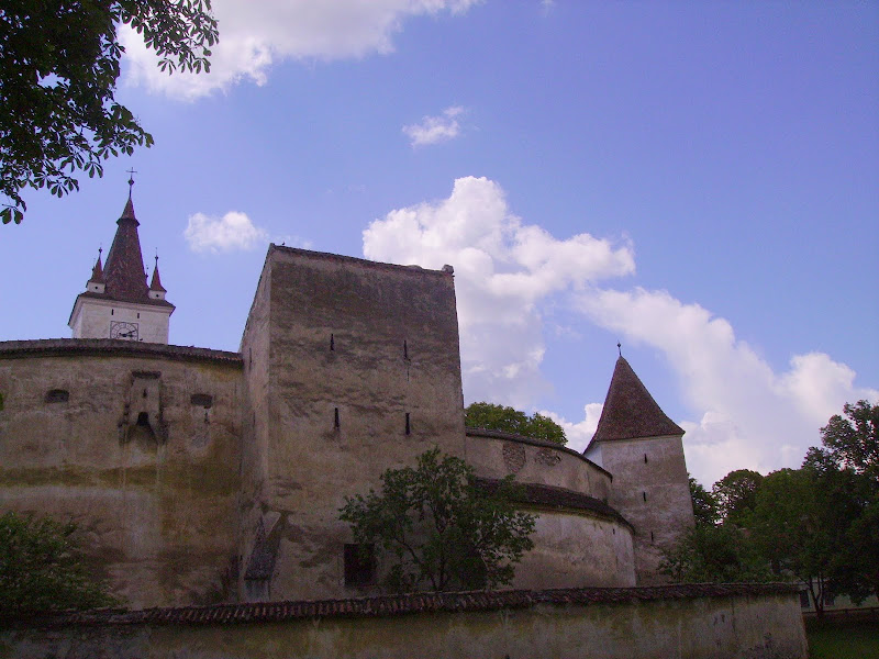
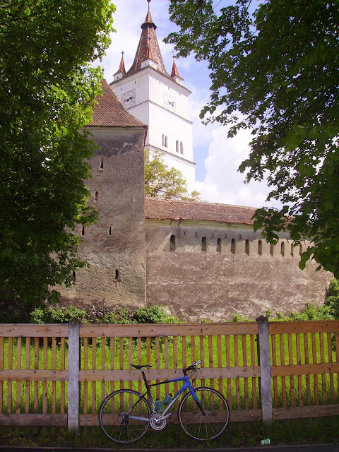
The 13 Decembrie street is leading me out of town and straight into Sânpetru (Petersberg) village. iti is mentioned for the first time in written documents at 1240 (“Mons Sancti Petri”), the fortified church having been erected shortly after the turk attack from 1432


The place looks very well, probably due to increased property interest in the area recently.
Sanpetru lies on the foot of the Lempes Hill (South-Western-wise of it). We will talk of it a it late - here just a glimpse of it's western slopes.


Entrance in Bod is sharply marked by a descent towards the Olt riverbed.


Bod's existence was first documented in 1211, when colonists between the Rhine and Moselle were brought. They got to be known by the local people uner the generic name of saxons. Following tartar invasion from 1241 the village was completely burnt down, thus the "Brenndorf" name in german (“burnt village”).
The remains of the citadelle are near the town hall (fortification mainly fell during the 1802 earthquake).

Dont know what I'm doing, just riding with no fuss. It's a quiet day, people handing over at their doors... and I suddenly see a milestone that says Zărneşti 36 km (?).
I stop to ask an old lady if this is the road to Feldioara but it obviously is not. I will have to turn right at the "Bârsa Bridge" and carry on on the E 60 european road.
This is also confirmed by an old man on an antique but resilient city bike, whom I met while crossing the bridge over the Ghimbăşel rivulet.
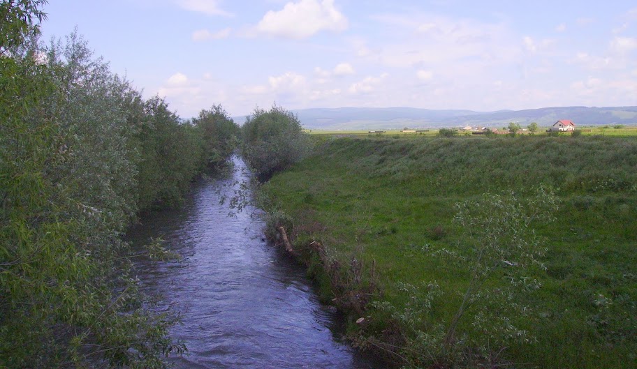
After that I head to the intersection with the main road DN1. And cross the river that lent its name this region: Bârsa, flowing under the bridge mentioned above.

Further, let's roll on this European road that leads me to Feldioara, as traffic is not too high today, so I feel at ease. I stop to take a remote picture of the town that the Saxons called Marienburg (or Castrum Sancti Maria in Latin documents and Hungarians Földvár - earth city).

Entry into Feldioara the E60 is via a short (but beautiful) climbing. As such, I return and climb it once more. In the meantime, a solitary rain cloud fools around above the old Transylvanian city.

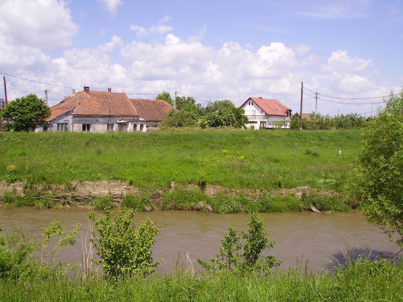
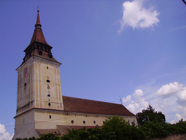
I'm slowly cycling around the streets in the centre, to the evangelical church. It's not in a very happy situation. Weeds invade its yard, large holes biting the walls. It served as headquarters of the Teutonic Knights in the Land of the Barsa river, in the thirteenth century. 100 meters further back that there are some ruins of the fortified city. Near the city starts a trail which may return me back to Bod, but is covered with gravel. That's also close to the point where Barsa lets itself absorbed into the greater Olt river, as a faithful left-hand tributary.

So I leave Feldioara on the north side, making a loop back. I got out of the city is via a descent. In fact, the city is located on a hill that dominates this part of the country.

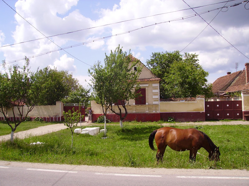
At the northern limit of the settlement, 2 beautful horses graze quietly.

A few steps from them, there passes the railway linking Brasov to Sighisoara.

And besides there flows the mighty river Olt, inflated by heavy rain.


I'm passing from Braşov to Covasna county. The hilly road goes through the village of Haghig, seen here from the railroad crossing.

Passing through Haghig, I immediately return into Brasov county. People are bathing in the sun on the banks of the same Olt river. I just keep roundly pedalling on and on.

Entry into Feldioara the E60 is via a short (but beautiful) climbing. As such, I return and climb it once more. In the meantime, a solitary rain cloud fools around above the old Transylvanian city.
I'm slowly cycling around the streets in the centre, to the evangelical church. It's not in a very happy situation. Weeds invade its yard, large holes biting the walls. It served as headquarters of the Teutonic Knights in the Land of the Barsa river, in the thirteenth century. 100 meters further back that there are some ruins of the fortified city. Near the city starts a trail which may return me back to Bod, but is covered with gravel. That's also close to the point where Barsa lets itself absorbed into the greater Olt river, as a faithful left-hand tributary.
So I leave Feldioara on the north side, making a loop back. I got out of the city is via a descent. In fact, the city is located on a hill that dominates this part of the country.
At the northern limit of the settlement, 2 beautful horses graze quietly.
A few steps from them, there passes the railway linking Brasov to Sighisoara.
And besides there flows the mighty river Olt, inflated by heavy rain.
I'm passing from Braşov to Covasna county. The hilly road goes through the village of Haghig, seen here from the railroad crossing.
Passing through Haghig, I immediately return into Brasov county. People are bathing in the sun on the banks of the same Olt river. I just keep roundly pedalling on and on.
I just mount my own 2 wheeled horse and pedal to Harman.
The road winds on the northeast side of the hill Lempes.

This is a special ecosystem, declared as nature reserve, as it reads here:

I'm taking a lunch break, then I surround the fortress at a slow pace. The fortification has 6 impressive towers, which bravely withstood the changing times.

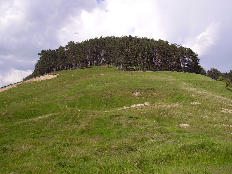
Riding again, I decide to give up exploring Prejmer. I'll get there some other time. That's because now ... I have another idea. I feel like climbing the Lempes hill. On foot, walking along the bike. This hill is nothing but an extension of Baraolt mountains, south of the Olt's riverbed.

It is also a very popular place for paragliders. Now I haven't seen any.
But climbing the hill slopes on a path between 2 houses ...
... I saw cyclists
") . Those children were riding their rigs until one did a somersault in the air and was tought into heading home together with his pals.
. Those children were riding their rigs until one did a somersault in the air and was tought into heading home together with his pals.

Meaning the Sânpetru village, which can be so nicely admired from above.

I take pictures of flowers, listening to crickets and birds.


I am right on the southern slope of the hill, where there are various botanical species are protected. Perhaps the most important is the yellow pasqueflower (Adonis vernalis), which they say is a medicinal herb.
The evangelical church of Sânpetru can be seen from here, between two dwarf trees.

Looking for a path that will help me and the bike descend safely. However, we must first climb a litle.

The bike is stunned - how come? Why are we riding on grass? On dust? But this is just the way it is : I've always liked to explore mountains on foot.
Anyhow, we finally managed to get down on the road and returned to Brasov railway station.
The map of today's stroll is here
http://www.bikemap.net/route/454194
In the station I was reunited with some of the bold racers who had reached Cheia in the morning, despite heavy rain they met along the way. We returned home by train and the MTB riders joined us along the route; they were obviously full of the mud they are longing for ")
Hoping you have enjoyed this story, I invite you once again to discover the beauties of Romania, on 2 wheels!
No comments:
Post a Comment